WELCOME TO JOURNEY's END
Monday, 6th April 2020
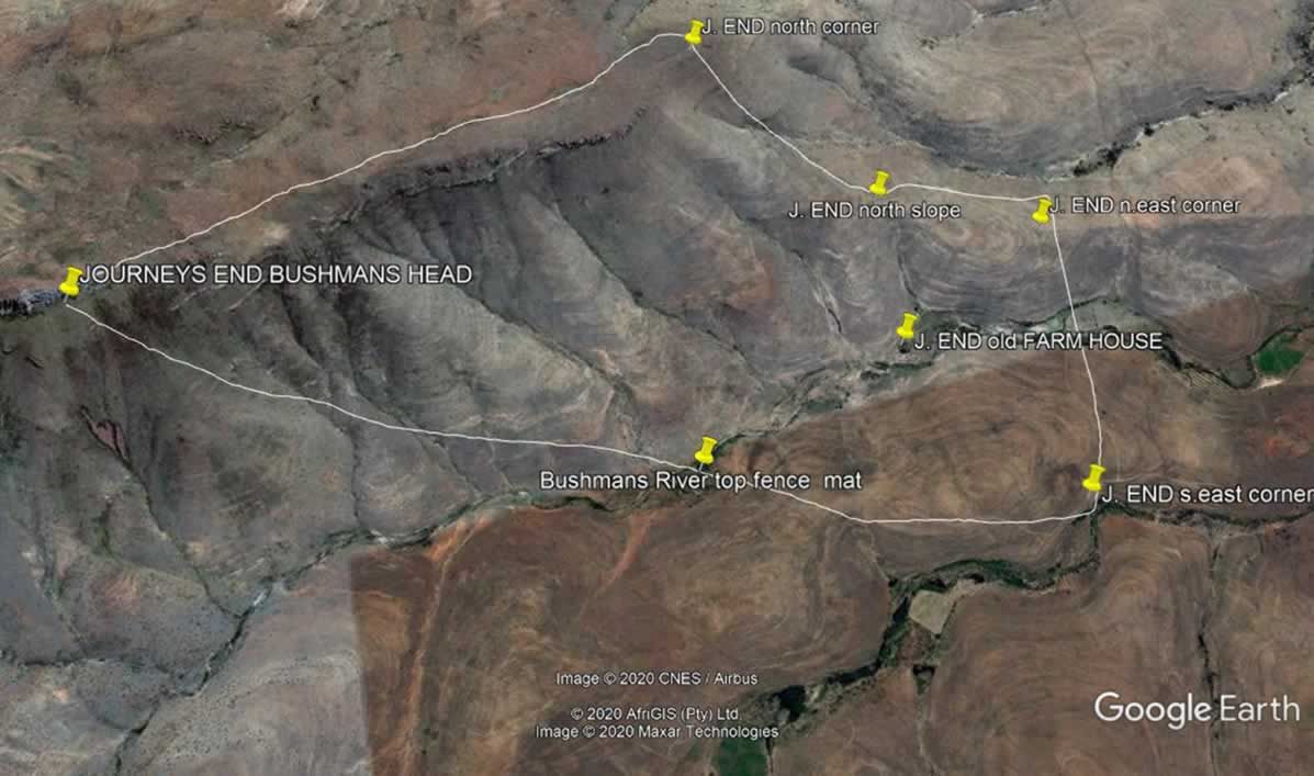
Our new Ranch is called 'Journey's End ' due to it's remote location and ruggedness. The satellite images below illustrate the geographical differences between our two ranches.
Journey's End Facts
2040 M above sea level at highest point on Bushmans Head with 1340 m at the bottom – So the mountain height is about 700 m ( 2300 ft ) !!
The terrain is open but undulating with many slopes. When hiking across one can see very far up or down presentiong one with excellant stalking opportunities.
The ranch is very mountainous - 517 ha but filled with game. It is located 30 km s west of our Lodge so quick to get to.
JOURNEY’s END LOCATION
32 04 S
25 04 E
Compare the terrain with that of our main ranches "CLIFTON" and "STIRLING" depicted on the picture below.
CLIFTON and STIRLING LOCATION
31 56 S
25 11 E